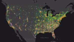
For Esri, Analytics All About Location, Location, Location

Certain analytic tools excel at manipulating with certain types of data. When it comes to data with a geographic bent, there may be no more influential vendor than Esri, a Southern California company that has quietly gobbled up a majority share of the geographic information systems (GIS) market. But now the company is positioning GIS as powerful way to visualize all types of data.
Esri owns anywhere from 40 to 70 percent of the market for GIS software, according to the Esri entry in Wikipedia. The company’s mapping software is well-known in fields where GIS is commonplace, such as energy, meteorology, land use planning, law enforcement, and public works. But a good chunk of its installed base of 1 million users are from industries where the case for GIS may not be as clear cut, such as real estate, retail, banking, insurance, journalism, and philanthropy. The Bill & Melinda Gates Foundation, for example, uses Esri to track the spread of polio, while Starbucks uses it to determine where to put new coffee shops.
According to Esri president and founder Jack Dangermond, GIS is on the verge of breaking out of its software category and fundamentally transforming how we collect and use all types of data. This is big data viewed through an Earth-sized lens, and it’s all part of an interconnected phenomenon that Dangermond calls Web GIS.
“Your GISs are becoming part of an interconnected platform,” he said during a keynote address this week at Esri’s user conference at UC San Diego, which was expected to attract more than 10,000 attendees, second in this city only to Comi Con. “Your apps are being fed by shared community content….and it’s co-evolving with everything else, like faster machines, Web services, and more open policies and networks.”
These are interesting times to be in the GIS business, he says. “Web GIS is bringing together all of our data, connecting it, our technologies, our people. My sense is it’s creating a framework where we can actually work on those very challenging problems” in areas of ecology, sociology, and economics.
Technological advances are making it possible to add a geographic element to “virtually everything we do,” Dangermond says. “It’s changing the way we think through seeing things differently. People describe this as a cyber infrastructure. Other people have called it the Internet of Things. I like to call it the nervous system of the planet. Web GIS is layering on top of that, bringing to life the planet’s information, your information, in various pieces, both inside your organization and beyond.”
Esri’s software has already been used to add geographic elements to social media information. You can hook the Twitter firehose up to Esri if you like, and watch the patterns of tweets play out on a digital map. But that’s just fun and games compared to where Dangermond sees Web GIS taking us.
Web GIS will be able to act with all types of data, he says. “Your maps are becoming Web services. Your analytics are becoming Web services, and real-time in-situ data and social media is being organization through Web services and Web maps,” Dangermond says. “Enterprise data, even big data [is being organized] through  a common language of Web services and Web maps.”
Much of this mapping work will be done through ArcGIS, the company’s flagship offering. The level of use of this product is astounding, quite frankly; the ArcGIS online portal is used to create “between 100 and 200 million maps per day,” Dangermond says.
One enterprise analytic software vendor that’s buying into Esri’s vision of our shared geographic future is software giant SAP, which announced this week that it’s deepening the existing integration between ArcGIS and its own HANA platform. As part of the expanded partnership, SAP HANA will be able to execute the actual GIS processing in its in-memory space, eliminating the need to move the data out to a separate ArcGIS server.
The integration is already paying dividends for Alliander, a Dutch utility company that used ArcGIS for analyzing its network of gas pipelines. According to the software vendors, doing the GIS processing in HANA enabled Alliander to reduce its processing from about 3.5 hours to about two to three seconds.
Esri has partnerships with other big analytic vendors, including IBM, Oracle, Microsoft, and Teradata. As the center of gravity in analytics shifts away from structured data towards unstructured and semi-structured content, Esri is moving with it. About a year ago it developed and released as open source its GIS Tools for Hadoop, which allows Hadoop to process geospatial data. It also released Geoprocessing Tools for Amazon Web Services (GP Tools for AWS), which does the same for Elastic MapReduce.
These are fascinating times in the GIS world. With the flood of data originating from mobile phones, social media, and sensors, the ability to exploit the geographic content and context can be an incredibly useful tool for data analysts working in any industry.
Related Items:
Postal Service Spots Fraud with Analytics
How Big Data Imagery from Satellites May Help Your Business
Location Intelligence Completes BI Puzzle


