Big Bird Data Project Probes Migrations

mbolina/Shutterstock
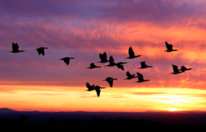
On a quiet spring or fall evening, high above, you may have heard the honking of migrating Canada Geese somehow flying in formation either due north or south. To determine just how our feathered friends accomplish these epic passages, a team of data scientists at the University of Massachusetts at Amherst will use more than 200 million archived radar scans from the U.S. national weather radar network to track the seasonal migrations.
The “Dark Ecology” Project will crunch 20 years of radar data using new analytics methods to be developed by a computer vision specialist at UMass along with the director of information science at Cornell University’s Laboratory of Ornithology. The project is supported by three-year grants to both schools from the National Science Foundation totaling more than $1.2 million.
Among the goals of the project—Dark Ecology is an allusion to dark matter and the fact that much undiscovered science is hidden from our view—is applying big data methods to what the researchers referred to as “eBird” observations. The researchers said their approach should reveal complex patterns of bird migrations that could assist with conservation efforts. Among those is the annual North American bird count sponsored by the Cornell lab.
“The Dark Ecology Project will develop new resources allowing us to estimate the densities of migrating birds over the U.S. each year for the last 25 years,” UMass computer scientist Daniel Sheldon explained in a statement announcing the project. The researchers added that the combination of radar and bird-tracking data would provide a detailed view of bird migrations across North America.
Migratory “data can tell us about bird distributions and which species are present at different locations and times of year, while radar data can tell us how birds are moving over the continent throughout the year,” Sheldon added.
While weather radar data is readily available and the network is sufficiently sensitive to detect migrating birds at night, the millions of images previously had to be studied individually. The university project will seek to automate the process by developing new big data handling techniques, the researchers said.
Access to NEXRAD radar scans was improved in 2015 when Amazon Web Services (NASDAQ: AMZN) forged a research agreement with the U.S. National Oceanic and Atmospheric Administration to increase the amount of data available via the cloud. The deal also dramatically reduced data access costs.
The researchers said they would leverage machine learning, computer vision and probabilistic inference algorithms to train computers used to automate analysis of radar images. Among the algorithms will be one used to screen out rain.
“Recent advances in machine learning and computer vision will let us teach the computer how to identify rain, birds, insects, location of bird roosts and other biological phenomena of interest to ecologists,” Sheldon noted.
Other machine learning algorithms will focus on extracting more data from radar scans. For instance, researchers want to plumb the large amounts of data between radar stations to produce “spatially detailed maps of migration density.”
Recent items:
Universities Roll Out New Data Science Programs
Meet Ray, the Real-Time Machine-Learning Replacement for Spark


