Location Solves Just Part of the Geospatial Challenge

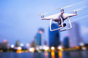
(Ammit Jack/Shutterstock)
There is no greater difference in how enterprises and consumers use technology than in their use of location data.
Location-based services on consumer mobile devices have set the expectation for ease of use and convenience. Ask your phone where the closest coffee shop is and it will find it, tell you how to get there, and may even order coffee.
Creating these location-specific experiences can be challenging, and may require the use of sophisticated geographic algorithms. The most successful location-based experiences for consumers are based on sequential activities. Where are you? Where do you need to go? What do you want to do when you get there? Many of these experiences are rooted in network connectivity and analysis
It is increasingly more complex for enterprises to extract benefit from location data, but the potential rewards are exponentially higher. The combination of location data and analytics powered by geographic information systems (GIS) are transforming how many industries work via IoT data integration, drone information mapping, autonomous vehicle navigation, and satellite imagery analysis.
We’re only beginning to understand how these new sources of information can help make better decisions.
Connectivity is a point of differentiation between consumers’ successful use of location services and the benefits that businesses can expect to obtain. Consumers have come to accept the limitation that without connectivity, location services aren’t available. However, enterprises shouldn’t be satisfied with the same. There is value in location data even at times of no connectivity.
Look at the challenges associated with recent winter storms that pounded large areas of the Northeast, leaving thousands without power for days during one of the coldest stretches of the season. A major issue was accurately identifying the location of problem spots, capturing the severity of specific problems, analyzing the information, and getting it into the hands of decision makers so they could make quick, informed decisions to deploy resources to plow roads and restore power.
With power and connectivity limited at best, and completely wiped out at worst, the flow of data into systems used to make decisions crawled to a halt. Decision makers weren’t armed with the right information when it was needed.
This is just one example of how the lack of connectivity can limit the value of GIS, and the problem is more significant than many realize.
Many parts of the world lack reliable, constant connectivity. Even here in the U.S., there are regional pockets without it. In large parts of Africa, connectivity simply doesn’t exist. On battlefields, connectivity is often jammed for the safety of troops on the ground. On airplanes and ships, it is highly restricted.
And yet, in each of these situations, location data is still critically important. It’s needed for anti-mining efforts in Africa, determining infringement zone violations in conflict areas, and tracking the fidelity of goods transported on planes, ships, and trains.
Fortunately, advances in geospatial intelligence can help avoid issues caused by no network connectivity. The ability to capture, validate, and analyze data offline and then sync when connectivity is available can vastly improve decision making.
The market for this type of location intelligence software is set to explode to $2.6 billion by 2021, according to Gartner. The analyst firm says, “Location Intelligence provides a way to reveal relationships between datasets that might not have otherwise been obvious or easy to ascertain and, through location analytics, arrive at the kind of insights that get reflected in the bottom line… In the combination of geographic and dynamic data, visualized on a map, Location Intelligence reveals characteristics that may have been otherwise obscured in a spreadsheet environment.”
With location intelligence, businesses can expand the sources of information and use it to make better decisions. Let’s go back to the winter storms in the Northeast. In addition to data collected from utility workers and public works employees plowing the roads, citizens could have helped provide additional data on unplowed roads, downed power lines, and report on other damage spots hindering recovery efforts.
Native device features can be used to collect and report different types of information. Cameras to capture video and photographs. GPS sensors to collect locations data. Microphones to capture voice notes. Data collection fields can be customized to obtain the most useful information, minimize the chances of collecting bad data, and provide the ability to capture the data and sync it when connectivity is available.
The speed of collecting, processing and analyzing more data from more sources is always valuable in making better decisions. With GIS, connectivity at the point of collection should no longer be a factor.
Industry leaders are just starting to realize the benefits of location intelligence. The ability to capture and analyze data while offline can help generate better results faster, and create enterprise-level location experiences that match – dare I say exceed – today’s consumer-level expectations.
About the author: Anthony Calamito is Chief Geospatial Officer of Boundless, an open GIS company, where he is responsible for product strategy and outreach, educational initiatives, and the company’s ongoing commitment to the open source community. Anthony is a steering committee member at LocationTech, and a Fellow of the American Geographical Society, and an adjunct instructor at George Mason University.
Related Items:
Searching Geospatial Data Gets Easier
The Here and Now of Big Geospatial Data
5 Ways Big Geospatial Data Is Driving Analytics In the Real World


