Esri Boosts ‘Velocity” of ArcGIS for IoT

Esri, the location intelligence and geospatial analytics specialist, is accelerating its Internet of Things analytics platform as more industries integrate geospatial sensor data and real-time analytics into their operations.
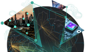
Formerly ArcGIS for IoT, ArcGIS Velocity is promoted as a cloud-native platform for ingesting, processing, visualizing and analyzing real-time geospatial data. Esri said Velocity complements current geographic information systems by “spatially enabling” current IoT data while providing real-time analytics.
The tool is described as an add-on capability to ArcGIS Online for ingesting data from IoT platforms, message brokers or third-party APIs. It then helps process, visualize and analyze real-time data feeds as well as store data and performing fast queries and analysis.
The company said Velocity’s Kubernetes-based architecture allows data ingestion from connected devices by configuring real-time feeds with historical data via stream and feature layers. Those capabilities are used to analyze time-series data.
The Velocity platform captures sensor data as well as moving objects or “anything that changes over time,” the company said. It then analysis ingested data to automatically spot patterns and anomalies. The result is “up-to-the-second data and improved situational awareness,” said Jack Dangermond, Esri’s founder and president.
Velocity outputs can be shared as maps or a streaming data service that can also be used with other ArcGIS applications, the company said. Among the spatial operations supported by the upgrade are buffering, geofencing, or virtual perimeters, along with pattern detection, spatial aggregation and enrichment and proximity alerting.
Esri, Redlands, Calif., said Wednesday (Feb. 3) it is offering Velocity under either “standard” or “advanced” licensing models. Once obtained, access is provided via ArcGIS Online. The new licenses vary in terms of computing and storage capabilities.
The new ArcGIS capability is aimed at commercial, government, natural resources, public safety, transportation and the utility sectors, among others.
Potential use cases include asset monitoring, predictive maintenance, process automation and other applications that leverage IoT sensor data.
Recent items:
How Geospatial Data Drives Insight for Bloomberg Users
Getting Creative with COVID-19 Contact Tracing
Kroger Tackles Childhood Hunger at Home with Geo-Analytics


